Lane County has an excellent portal to parcel maps and property owner data. Visualizing this data at a higher level reveals interesting features wrt land use and ownership.
Interactive maps and tables are here.
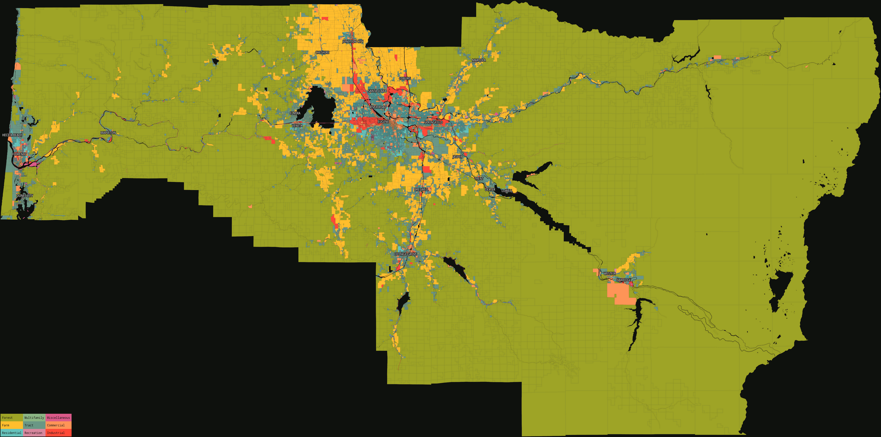
County map, by property class (3484×1729, 703kB):
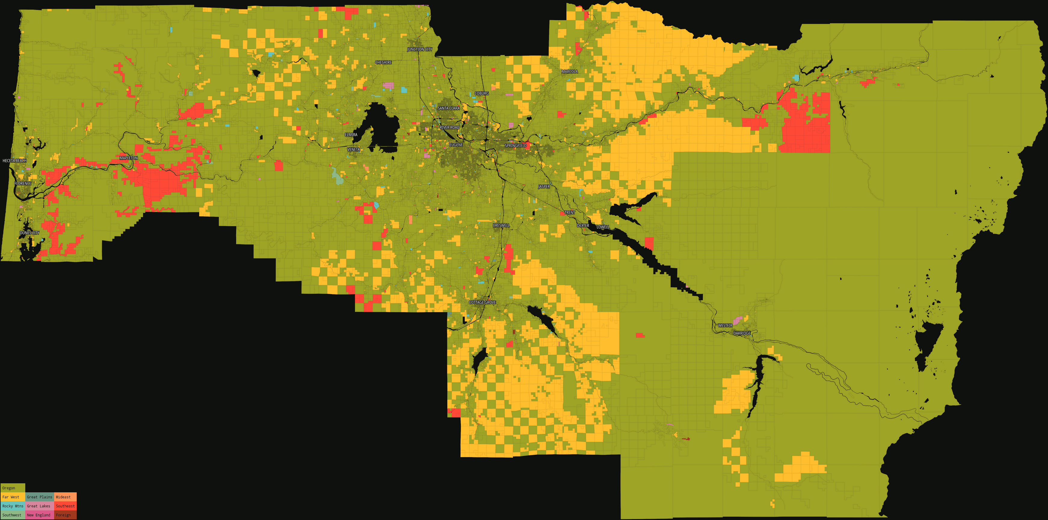
County map, identifying out-of-state land owners by classifying by region/state (3484×1729, 741kB):
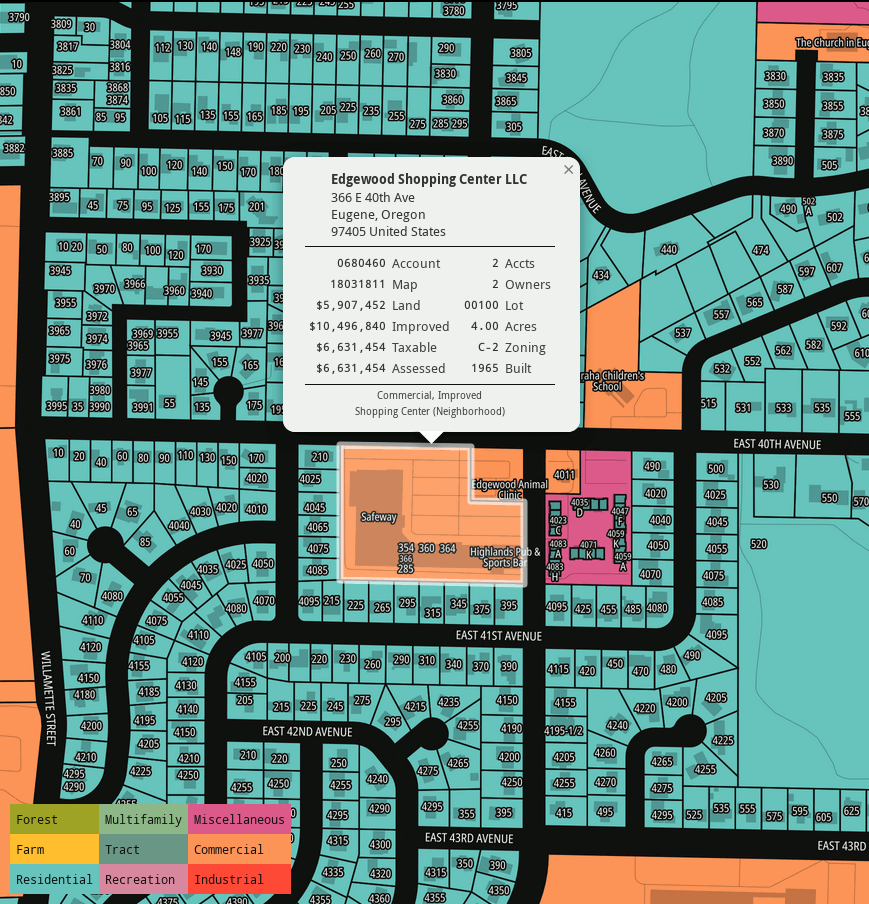
Large map, Springfield-Eugene area, by property class, without legend (5000×2728, 2.7MB):

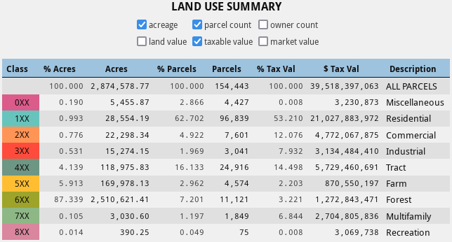
Land use, in aggregate:
Owner location, in aggregate:

Owner location, in detail:

Top 1000 owners, by…, cropped:


You must log in or register to comment.
This is really freaking cool. I had no idea it existed.
